Lil Travel Folks is supported by its readers. If you purchase through a link on my site, I may earn a commission. Learn more
Are you planning a trip to the Great Smoky Mountains National Park and wondering how long does it take to hike to Laurel Falls? This popular trail is known for its stunning waterfall and easy accessibility, making it a good choice for hikers of all skill levels.
- The Laurel Falls trail is approximately 2.6 miles roundtrip, with the hike to the falls taking about 1.5-2 hours on average.
- The trail is paved at the trailhead, but the pavement is rough and uneven and does not extend the full length of the trail.
- Pets and bicycles are prohibited, so plan accordingly.
Hiking to Laurel Falls is a great outdoor activity for visitors to the park. Whether you’re looking for an easy hike or one of the most popular trails in the park, Laurel Falls is a great place to start. In this article, we’ll provide an overview of Laurel Falls and offer tips for planning your visit.

Overview of Laurel Falls
If you’re looking for a peaceful walk surrounded by natural beauty, then hiking to Laurel Falls is a must-do activity when visiting the Great Smoky Mountains National Park. Located in the Laurel Falls TN area, this trail is one of the most popular hikes in the park, thanks to its only waterfalls.
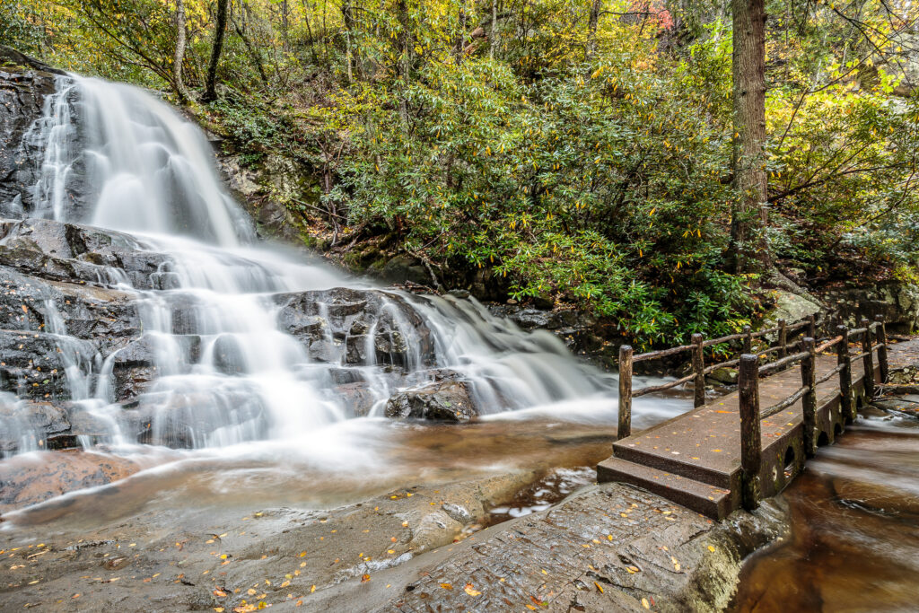
The trail is a moderate 2.6-mile round trip, and it takes about two hours to hike to the 80-foot waterfall and back. The trail is paved at the trailhead, but the pavement is rough and uneven and does not extend the full length of the trail.
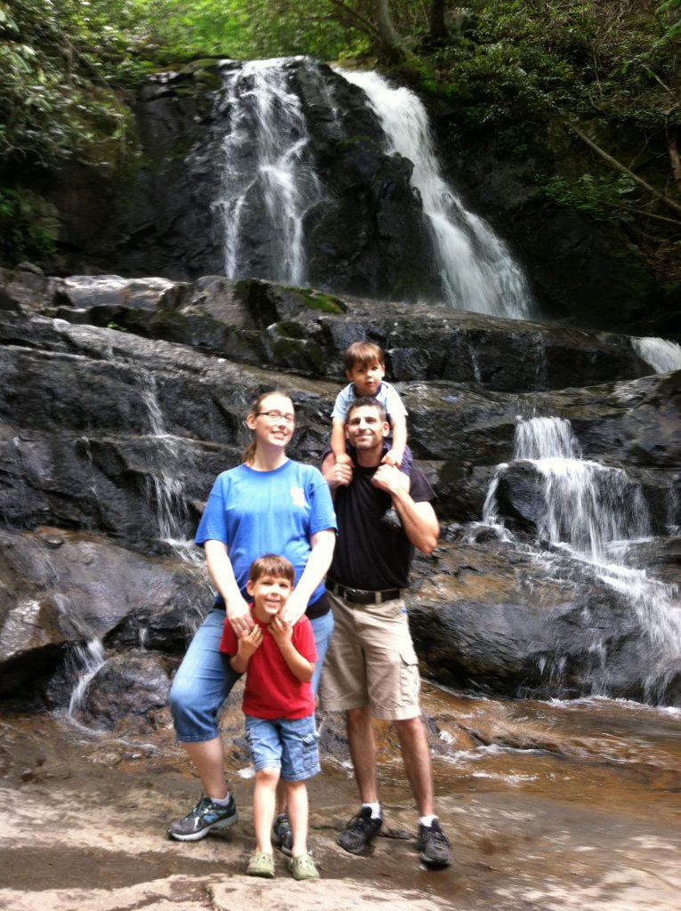
As you make your way to the base of the upper falls, you’ll be encompassed by the breathtaking mountain views. The falls themselves are a stunning sight to behold, and you can take in their beauty from the observation deck.
The Laurel Falls trail is open year-round, and it’s a beautiful place to visit anytime. However, it’s important to note that pets and bicycles are prohibited on the trail.
Overall, hiking to Laurel Falls is an excellent way to enjoy the natural area and take in the beauty of one of the only waterfalls in the park. So, grab your hiking shoes and enjoy the peaceful walk to the stunning Laurel Falls.
Hiking to Laurel Falls
If you’re planning to hike to Laurel Falls, there are a few things you should know before you go. This moderate hike is a popular destination in the Great Smoky Mountains National Park, and it’s easy to see why. With its beautiful waterfall and stunning scenery, it’s a must-see for anyone visiting the area.
Trailhead and Parking
The trailhead for Laurel Falls is located off Little River Road, about 3.5 miles west of the Sugarlands Visitor Center. There is a parking lot at the trailhead, but it can fill up quickly, especially during peak season. If the lot is full, you can park at the Sugarlands Visitor Center and take the shuttle to the trailhead.
Trail Description
The Laurel Falls Trail is a 2.6-mile roundtrip hike that takes you through an old-growth forest and along the Laurel Branch Stream. The trail is paved at the beginning, but it becomes rough and uneven as you get closer to the falls. There are also some steep drop-offs along the way, so be careful.
The steep drop-offs made me a bit nervous when our sons were 5 and 2, but we didn’t have any issues and there were lots of families and small children making the hike. I was 7 months pregnant and did the hike easily.
The trail crosses a small bridge over the stream and passes by Cataract Falls before reaching Laurel Falls. The waterfall is 80 feet tall and is one of the most photographed waterfalls in the park. You can view the falls from the front or from the back trail, which offers a different perspective.
Skill Levels and Safety
The Laurel Falls Trail is considered to be an easy hike, but it does have some moderate sections. The elevation gain is about 314 feet, and the trail can be rocky and slippery in places. It’s important to wear sturdy shoes and bring plenty of water.
If you’re hiking with small children or the whole family, the paved path to the falls is a great option. Just be aware of the drop offs and keep children with you at all times.
When hiking in the Great Smoky Mountains National Park, it’s important to follow safety guidelines. Stay on the trail, watch your step, and don’t get too close to the edge of the trail or the waterfall.
Also, be aware of wildlife if you’re hiking in bear country. We did see a mama bear and two cubs from a distance when we hiked Laurel Falls.
Overall, hiking to Laurel Falls is a great way to experience the beauty of the Great Smoky Mountains National Park. Whether you’re looking for an easy hike with the family or a more challenging adventure, this trail has something for everyone.
Getting to Laurel Falls
If you’re planning to hike to Laurel Falls, there are a few different ways to get there. Here’s a breakdown of the different options:
By Car
If you’re driving, the easiest way to get to the Laurel Falls trailhead is to take Fighting Creek Gap Road, which turns into Little River Gorge Road. From there, it’s about a mile to the trailhead. If you’re coming from the Cades Cove Loop Road or Downtown Gatlinburg, it should take you around 30 minutes to get there.
If you’re coming from the Roaring Fork Motor Nature Trail, you can take Cherokee Orchard Road to the Gatlinburg Bypass and then turn onto Little River Gorge Road.
By Shuttle
If you don’t want to drive, there are shuttle services available that will take you to the trailhead. The Gatlinburg Trolley has a stop at the Sugarlands Visitor Center, which is a short walk from the trailhead. There are also private shuttle services available that will pick you up from your hotel or cabin and take you to the trailhead.
By Foot
If you’re staying at the Metcalf Bottoms Picnic Area, you can hike to the trailhead from there. The hike is about 4 miles roundtrip and takes you through some beautiful scenery.
No matter how you get to the trailhead, make sure to bring plenty of water and wear appropriate footwear. The hike to Laurel Falls can be strenuous at times, so it’s important to be prepared.
Planning Your Visit
When planning your visit to Laurel Falls, there are a few things you should keep in mind to ensure a smooth and enjoyable experience. Here are some important factors to consider:
When to Go
Laurel Falls can get quite crowded during peak season, which is typically from late spring to early fall. If you want to avoid the crowds, consider visiting during the off-season or on weekdays. Keep in mind that the trail can be slippery and dangerous during winter months, so plan accordingly.
Reservations and Permits
While reservations are not required to hike to Laurel Falls, it’s a good idea to check if the park is accepting parking reservations during peak season. This can help you avoid long lines and ensure you have a spot to park. Additionally, if you plan on camping in the backcountry, you will need to obtain a printed backcountry permit from the park office.
Facilities and Amenities
There are bathrooms located at the trailhead for your convenience, but there are no facilities along the trail itself. Make sure to bring plenty of water and snacks, and pack out all of your trash to help keep the park clean. In case of emergency, fire crews have access to the trail but it is always best to be prepared and carry a first aid kit with you.
Overall, with a little bit of planning, your visit to Laurel Falls can be a memorable experience. Enjoy the beautiful scenery and take your time on the trail – the round trip hike takes about 2 hours, but you may want to spend more time exploring the area. Just remember to follow park rules and regulations, and respect the natural environment.
Other Attractions Near Laurel Falls
If you’re planning a trip to Laurel Falls, there are plenty of other attractions nearby that you won’t want to miss. Here are some suggestions for other outdoor activities, hikes, and waterfalls in the area to help you make the most of your visit.
Nearby Hikes
If you’re looking for more hiking opportunities in the area, there are several great options. Andrews Bald is a popular hike that offers stunning views of the surrounding mountains. The trail is 3.5 miles roundtrip and is rated as moderate in difficulty. Clingmans Dome is another popular hike in the area, offering panoramic views of the Smokies. The trail is 1.2 miles roundtrip and is also rated as moderate in difficulty.
Nearby Waterfalls
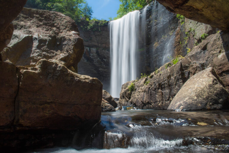
In addition to Laurel Falls, there are several other waterfalls in the area worth visiting. Abrams Falls is a popular option, with a 5-mile roundtrip hike to a beautiful 20-foot waterfall. High Laurel Falls is another great option, with a 3-mile roundtrip hike to a stunning 80-foot waterfall. Mooney Falls is also nearby, with a 3.5-mile roundtrip hike to a picturesque 50-foot waterfall.
Other Outdoor Activities
If you’re looking for other outdoor activities in the area, there are plenty of options. Cades Cove Loop is a scenic drive that offers stunning views of the mountains and wildlife. The loop is 11 miles long and is open year-round. If you’re looking for more hiking opportunities, there are several other trails in the area worth exploring, including the Alum Cave Trail and the Chimney Tops Trail.
Overall, there are plenty of other attractions near Laurel Falls that are worth visiting. Whether you’re looking for more hiking opportunities, waterfalls, or other outdoor activities, there’s something for everyone in the area. Just be sure to plan ahead and check for any closures or restrictions before you go.